


• Prime Tillable Land • Wooded Recreational Land • 23 Miles East of Bellefontaine • 10 Miles West of Richwood • 13 Miles North of Marysville

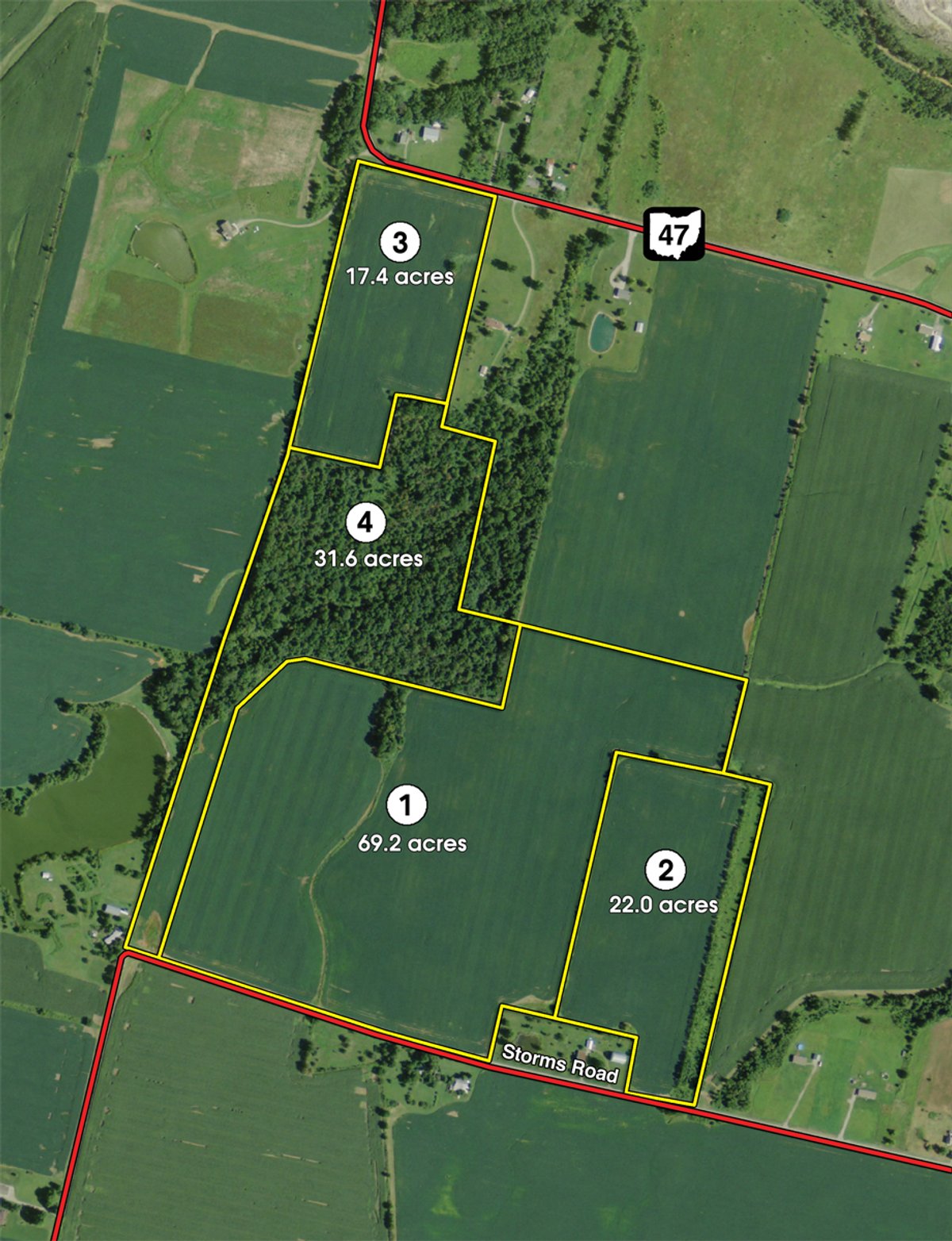
140.2 +/- Acres Offered in 4 Tracts
Marysville, OH - Union County
Owner: Michael Foos, Joseph Foos & Sue Harmon Wed, Nov 14, 2012 EASTERNAUCTION IS OVER
TOTAL SOLD: $725,000
| Tract(s): 1-4 | @ $725,000 | ($5,169/acre) |
OPEN HOUSE/INSPECTION DATES
Wednesday, October 24, 4-6PM
Meet a Schrader representative at Tract 2.
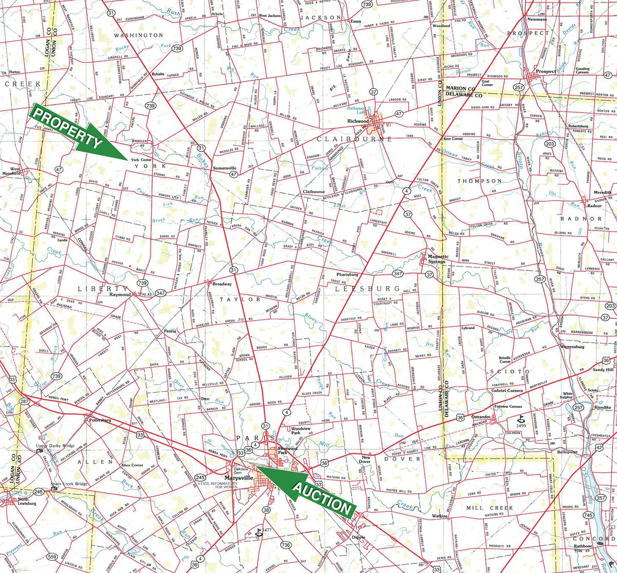
PROPERTY LOCATION
Directions to Tracts 1, 2 & 4: From Marysville, take St. Rte. 31 N for 11.5 miles to St. Rte. 47. Turn west and travel 2.1 miles to St. Rte. 739. Turn south and travel .6 mile to Storms Rd. Turn west and travel .4 mile to property on north side of road.
Directions to Tract 3: From Marysville, take St. Rte. 31 N for 11.5 miles to St. Rte. 47. Turn west and travel 2.7 miles to the property on south side of road.
AUCTION LOCATION
American Legion Post 79. 500 Park Ave., Marysville, OH 43040. From Main St. in downtown Marysville, turn west on W. 5th St. Travel approximately 1 mile to Park Ave. Turn north into American Legion Memorial Park. Watch for signs.
TRACT DESCRIPTIONS
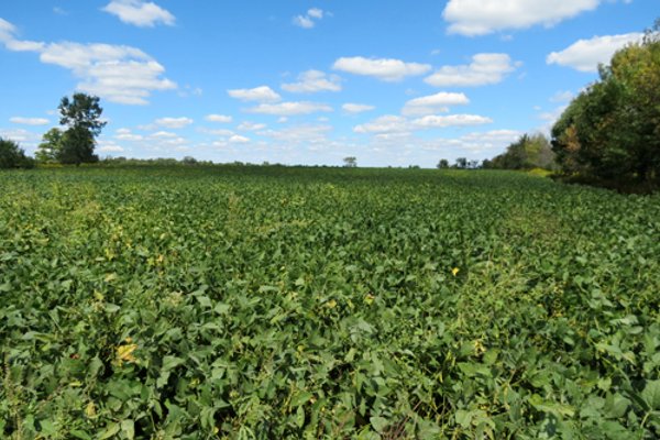
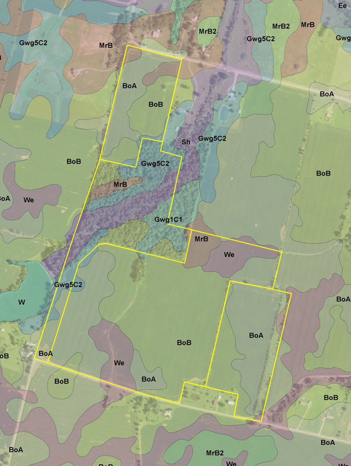
Tract 1: 69.2± ac of mostly tillable prime crop land. This tract features Blount Silt Loam and Wetzel Silty Loam as the predominate soil types. Tract 1 would make an excellent addition to any present farming operation with its quality soils and easy access along Storms Rd.
Tract 2: 22± ac with 18.5 +/- acres of tillable, highly productive land. There are 300 +/- feet of frontage along Storms Rd. Consider the possibilities this tract has to offer.
Tract 3: 17.4 +/- acres mostly tillable productive farmland with Blount Silt Loam and Morley Silt Loam soils. There are 500 +/- feet of frontage along St. Rte. 47. Investigate the income potential.
Tract 4: 31.6± ac acres with 155 feet of owned access along Storms Rd. This tract is mostly wooded with wildlife in abundance! If you desire a private, wooded tract ideal for hunting and recreational purposes, here it is.
AREA MAP
TRACT MAP(S)
SOIL INFORMATION
AREA MAP(S)
PROCEDURE: The property will be offered in 4 individual tracts and as a total 140.2 +/- acre unit. There will be open bidding during the auction as determined by the Auctioneer. Bids on individual tracts and the total property may compete.
DOWN PAYMENT: 10% down payment on the day of auction for individual tracts or combination of tracts. The down payment may be made in the form of cashiers check, personal check, or corporate check. Your bidding is not conditional upon financing, so be sure you have arranged financing, if needed, and are capable of paying cash at closing.
ACCEPTANCE OF BID PRICES: Successful bidder(s) will be required to enter into purchase agreement at the auction site immediately following the close of the auction. All final bid prices are subject to the Sellers acceptance or rejection.
EVIDENCE OF TITLE: The Seller agrees to furnish Bidders a preliminary title opinion to review. If Buyer(s) elect to have title insurance, the entire cost of the owners title insurance will be the responsibility of the Buyer(s). Seller agrees to provide merchantable title to the property subject to matters of record, general conditions of title, and similar or related matters. All tracts sold AS IS.
DEED: A Warranty deed will be delivered at closing.
CLOSING: Closing shall take place 30 days after auction date, or as soon thereafter as applicable closing documents are completed.
POSSESSION: At closing with tenants rights of the cropland.
REAL ESTATE TAXES: Buyer will assume taxes due and payable in 2013 and thereafter. Buyer pays any ditch assessments due after closing. If land usage is changed, the Buyer is responsible for CAUV Recoupment.
ACREAGE: All boundaries are approximate and have been estimated based on current legal descriptions.
SURVEY: A new survey will be made where there is no existing legal description or where new boundaries are created by the tract divisions in this auction. Buyer(s) and Seller shall share survey expense 50:50. FSA INFORMATION: Contact Auction Company for farm number and farm bases.
EASEMENTS: Sale of the property is subject to any and all easements of record.
MINERAL RIGHTS: The sale shall include 100% of the mineral rights owned by the Seller.
AGENCY: Schrader Real Estate and Auction Company, Inc. and its representatives are exclusive agents of the Seller.
DISCLAIMER AND ABSENCE OF WARRANTIES: All information contained in this brochure and all related materials are subject to the terms and conditions outlined in the Purchase Agreement. The property is being sold on an AS IS, WHERE IS basis, and no warranty or representation, either expressed or implied, concerning the property is made by the Seller or the Auction Company. All sketches and dimensions in the brochure are approximate. Each potential bidder is responsible for conducting his or her own independent inspections, investigations, inquiries, and due diligence concerning the property. The information contained in this brochure is subject to verification by all parties relying on it. No liability for its accuracy, errors, or omissions is assumed by the Seller or the Auction Company. Conduct of the auction and increments of bidding are at the direction and discretion of the Auctioneer. The Seller and Selling Agents reserve the right to preclude any person from bidding if there is any question as to the persons credentials, fitness, etc. All decisions of the Auctioneer are final.
ANY ANNOUNCEMENTS MADE THE DAY OF THE SALE TAKE PRECEDENCE OVER PRINTED MATERIAL OR ANY OTHER ORAL STATEMENTS MADE.

Click to access


