


•
MAJOR LAND AUCTION
•
833+/- Acres offered in 15 tracts
•
811+/- Tillable Acres
•
Highly Productive Treaty Soils
•
Investment Potential
•
County Drainage Outlets
•
Grain Storage System (Possession 8-1-14)
•
Immediate Possession on Tillable Land for 2014
•
5+/- Miles West of Muncie, Indiana
•
2+/- Miles North of Yorktown, Indiana

MAJOR LAND AUCTION, 833+/- Acres offered in 15 tracts, 811+/- Tillable Acres
Delaware County, Indiana, Mt. Pleasant & Harrison Townships
Owner: Dale & Nina Lee, Mark Lee Tue, Apr 8, 2014 EASTERNAUCTION IS OVER
TOTAL SOLD: $7,900,000
| Tract(s): 1-15 | @ $7,900,000 | ($9,482/acre) |
OPEN HOUSE/INSPECTION DATES
Saturday, March 15th from 10AM-NOON
Saturday, March 22 from 10AM-NOON
Meet a Schrader Representative at Tract 15
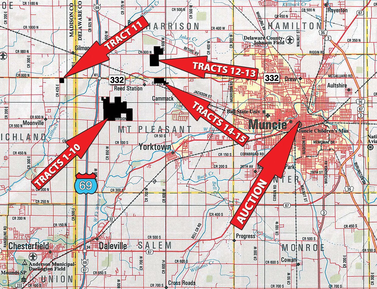
PROPERTY LOCATION
Tracts 1-10: From the intersection of I-69 and SR 332 travel east 1 mile to CR 820W. Turn right (south) for .1 mile to CR 150N. Turn right (west) following bends in the road for .8 miles to farm.
Tract 11: From the intersection of I-69 and SR 332 travel west 2 miles to farm on the left (south).
Tracts 12-13: From the intersection of I-69 and SR 332 travel east 3.5 miles to CR 600W. Turn left (north) and travel 1 mile to CR 300N. Turn left (west) and travel .5 miles to the farm.
Tracts 14-15: From the intersection of I-69 and SR 332 travel east 3.5 miles to CR 600W. Turn right (south) .2 miles to farm.
AUCTION LOCATION
Horizon Convention Center, 401 S. High St., Muncie, IN 47305.
From the intersection of I-69 and SR 332 travel east 8 miles to Wheeling Ave. (Bob Evans Restaurant on the corner). Turn right (southeast) and travel 1.8 miles, cross the White River bridge, road veers right (south) and becomes High St. Continue to 401 S. High St., on the right. Parking at lot on south end.
PROPERTY DESCRIPTION
Contact Auction Company for Detailed Information Book or CD with Additional Due-Diligence Materials on the Property.
ONLINE BIDDING AVAILABLE: You may bid online during the auction at www.schraderauction.com. You must be registered One Week in Advance of the Auction to bid online. For online bidding information, call Kevin Jordan at Schrader Auction Co. - 800-451-2709.
TRACT DESCRIPTIONS
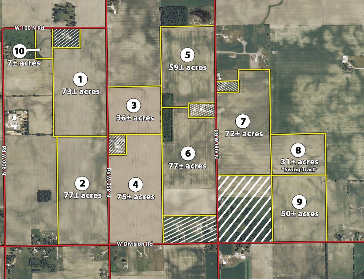
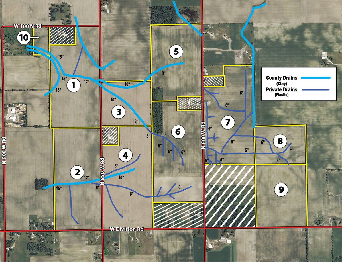
Tract 1: 73± ac Mostly all tillable with frontage on CR 100N and 850W. Dominant soil types are Crosby silt loam and Treaty silty clay loam. County drainage tile in two locations. A nice investment tract with good operating efficiency.
Tract 2: 77± ac Mostly all tillable with frontage on CR 850W and Division Rd. The soils are Treaty silty clay loam (63%) and Crosby Silt loam (37%). County drainage tile in two locations. A top quality productive tract.
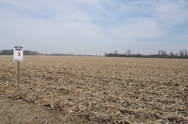
Tract 3: 36± ac Mostly all tillable with frontage on CR 850W. The soils are mostly Treaty silty clay loam (63%) and Crosby silt loam (37%). A county drainage tile crosses this tract. A productive parcel - perfect to combine with Tract 4 for a larger holding.
Tract 4: 75± ac Mostly all tillable with frontage on CR 850W and Division Rd. Soils types are Crosby silt loam and Treaty silty clay loam. County drainage tile in place across this parcel. An excellent investment tract.
Tract 5: 59± ac Mostly tillable with about 2 acres wooded. Has frontage on CR 850W. The soils are Crosby silt loam and Treaty silty clay loam. County drainage tile extends into this tract. Consider combining with Tract 6.
Tract 6: 77± ac Mostly tillable with about 5 acres wooded. Has frontage on CR 850W. The soils are Treaty silty clay loam (52%) and Crosby silt loam (47%). Private tile installed on this parcel.
Tract 7: 72± ac Mostly all tillable with frontage on CR 850W. The soils are Treaty silty clay loam (59%) and Crosby silt loam (41%). County drainage ditch borders the east side and provides an excellent outlet for the owner-installed tile.
Tract 8: 31± ac Swing Tract mostly all tillable. The soils are Crosby silt loam and Treaty silty clay loam. This tract has owner-installed tile that outlets into the County drainage ditch on Tract 7. This tract may be bid on by an adjoining landowner or in combination with Tract 7 and/or Tract 9.
Tract 9: 50± ac Mostly all tillable with frontage on Division Road. The soils are Crosby silt loam and Treaty silty clay loam. Consider combining with Tract 8 for a larger holding.
Tract 10: 7± ac Mostly tillable with about .5 acres wooded. County tile crosses the south end. Has frontage on CR 100N. Nice tract for your home in the country or combine with Tract 1.
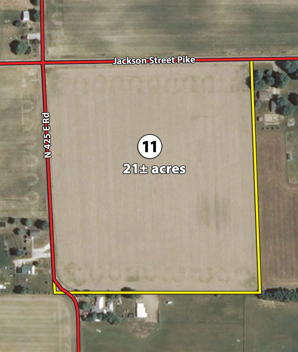
Tract 11: 21± ac Mostly all tillable with frontage on SR 332 and CR 425E. The soils are Celina silt loam, Brookston silty clay loam, and Crosby silt loam.
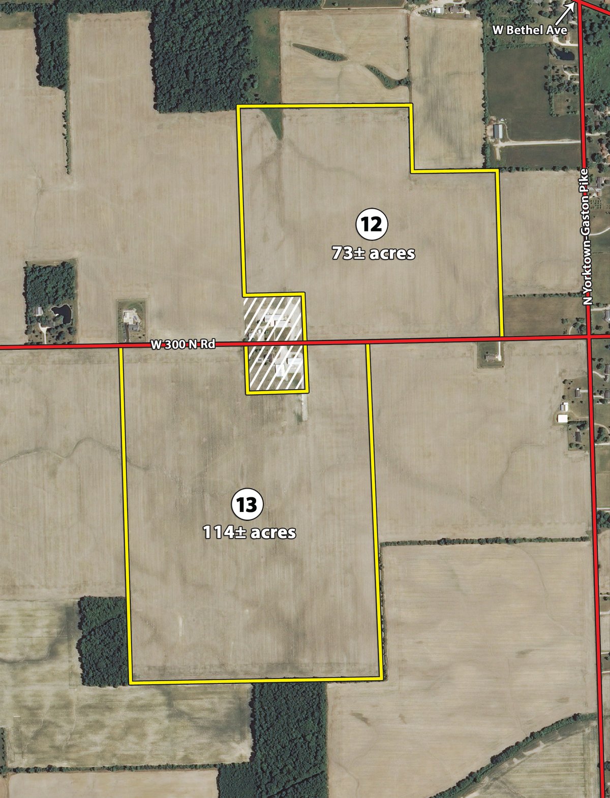
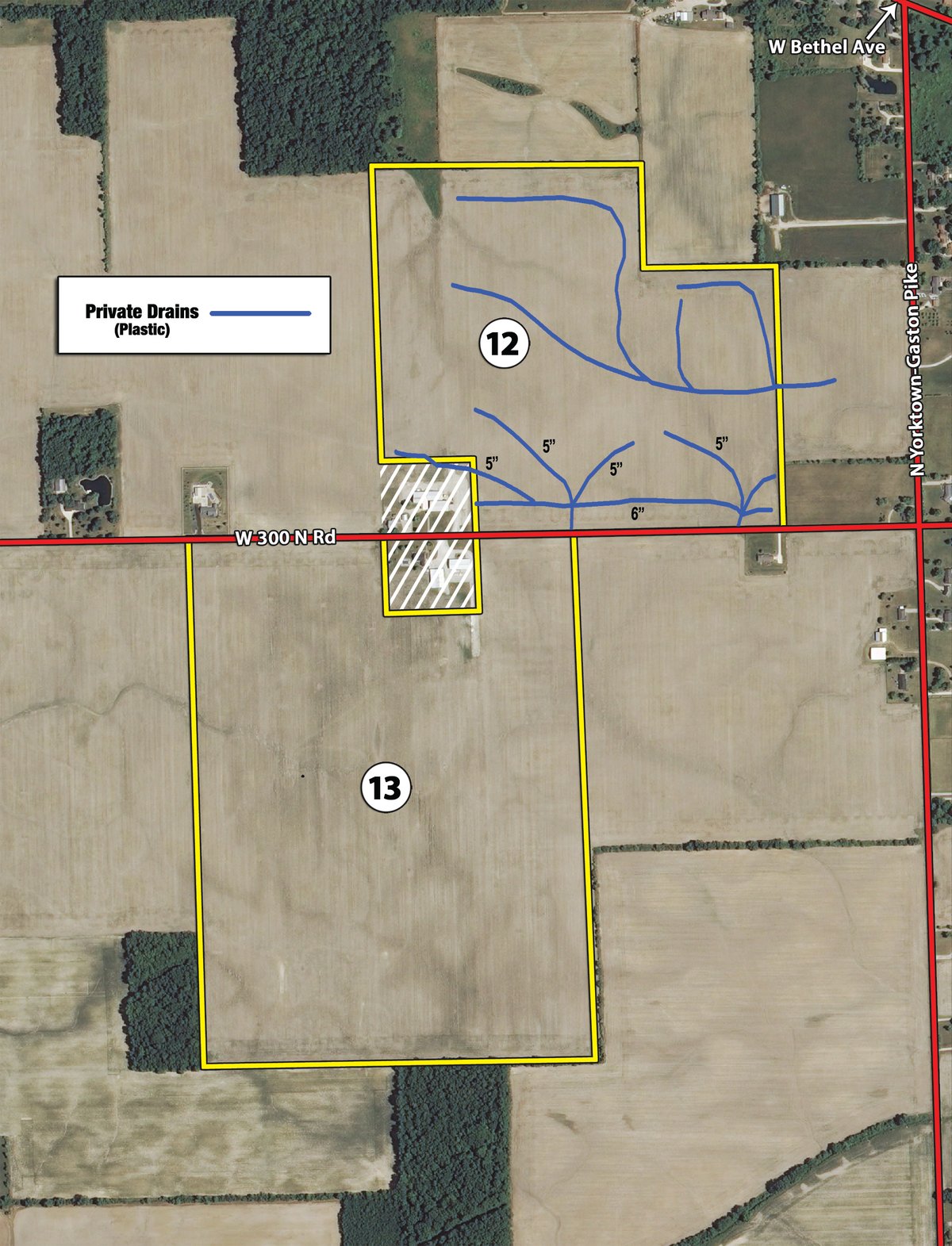
Tract 12: 73± ac Mostly all tillable with frontage on CR 300N. The soils are Blount Del-Rey silt loam, Pewamo silty clay loam, Celina silt loam, Glynwood silt loam, Brookston silty clay loam, and Crosby silt loam. Owner-installed tile drainage in place.
Tract 13: 114± ac Mostly all tillable with frontage on CR 300N. The soils are Blount Del-Rey silt loam and Pewamo silty clay loam. Owner has installed private tile drainage on this tract.
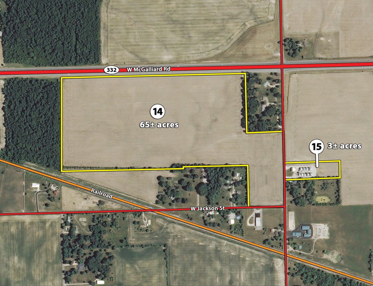
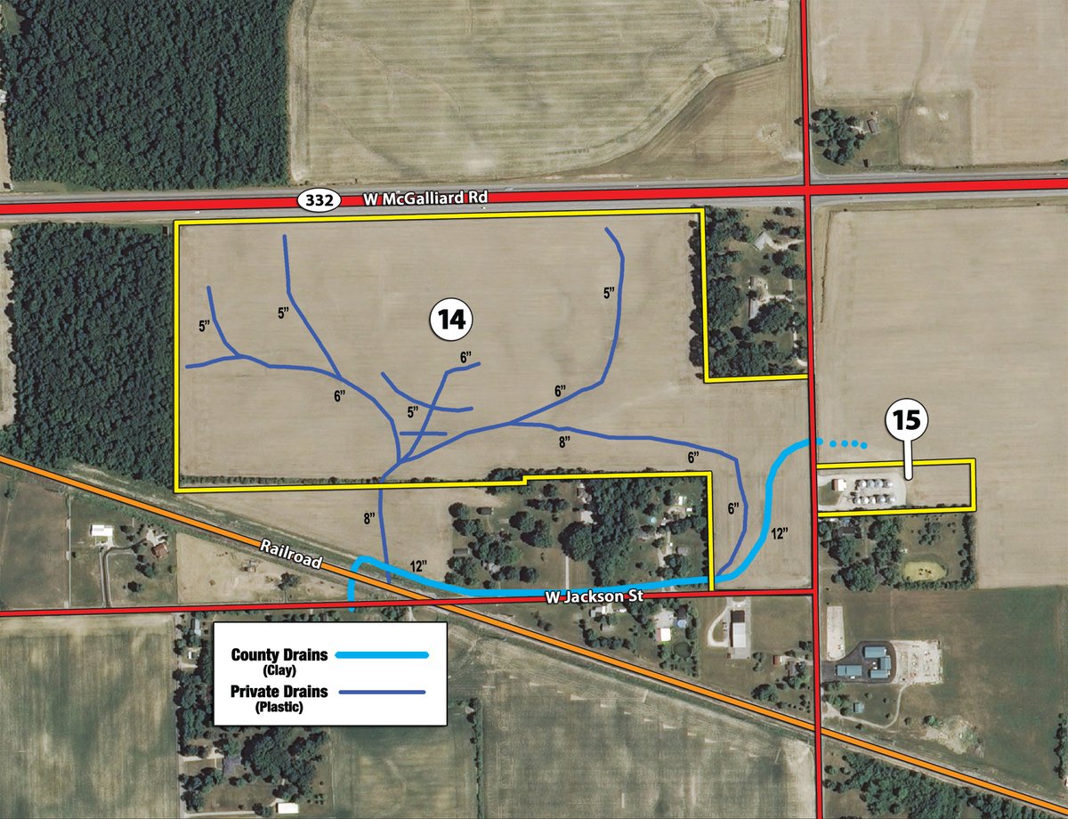
Tract 14: 65± ac Mostly tillable with frontage on CR 600W and Limited Access frontage on SR 332. The soils are Blount Del-Rey silt loam, Pewamo silty clay loam, and Blount silt loam. A County drainage tile is in place across the south end. The owner has also installed additional private drainage tile on this tract. High visibility from SR 332.
Tract 15:
3± ac
156,000 bushel grain bin storage and drying facility. Bins have aeration floors, fans, bin sweeps, and unload augers. Air system updated in 2009 with new air lock and blower. Dryer is a Farm Fans CFB 270. Single phase electric. The grain dump is a pit and swing-away auger combination.
Note: Possession of the Grain Bins on Tract 15 will not be until August 1, 2014.
AREA MAP
TRACT MAP(S)
Tracts 1-10
Drainage Map
Tract 11
Tracts 12-13
Drainage Map
Tracts 14-15
Drainage Map
SOIL INFORMATION
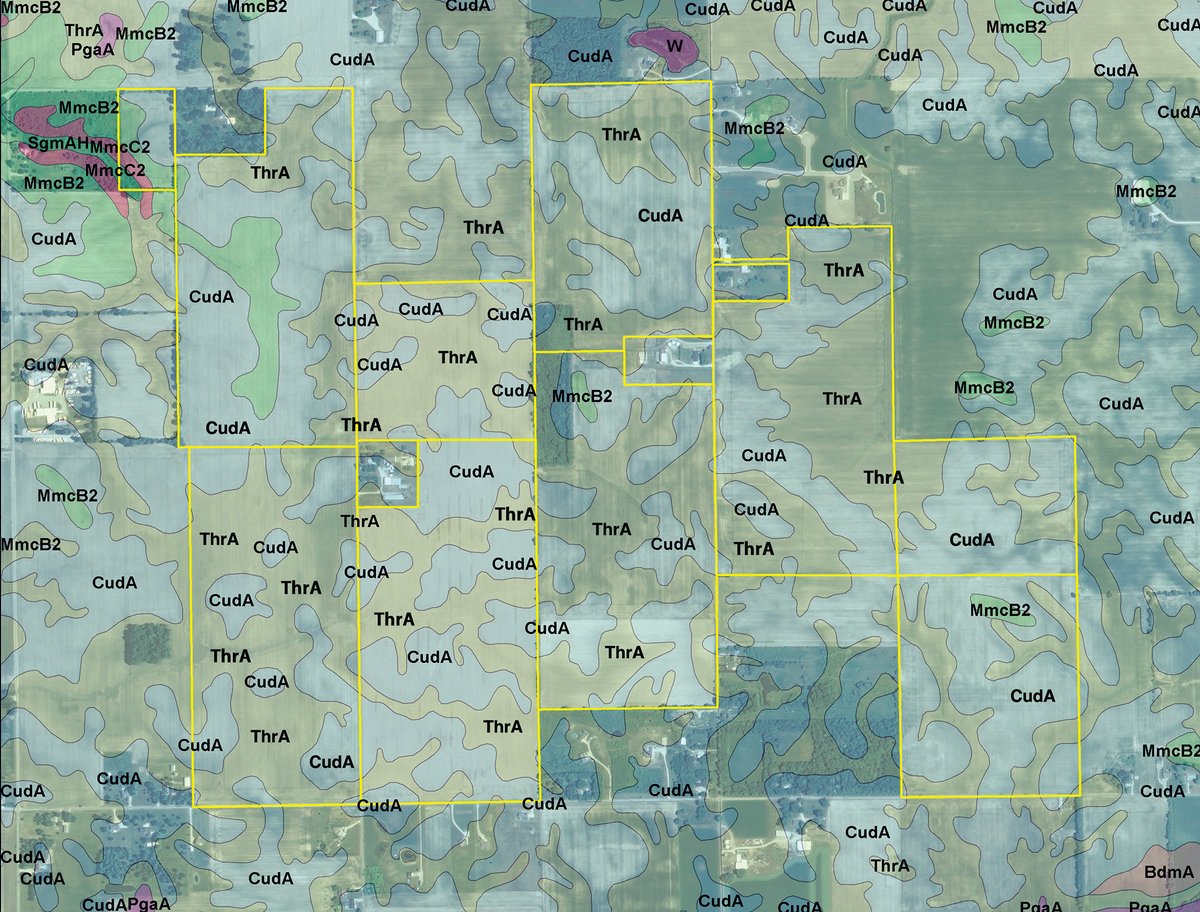
Tracts 1-10
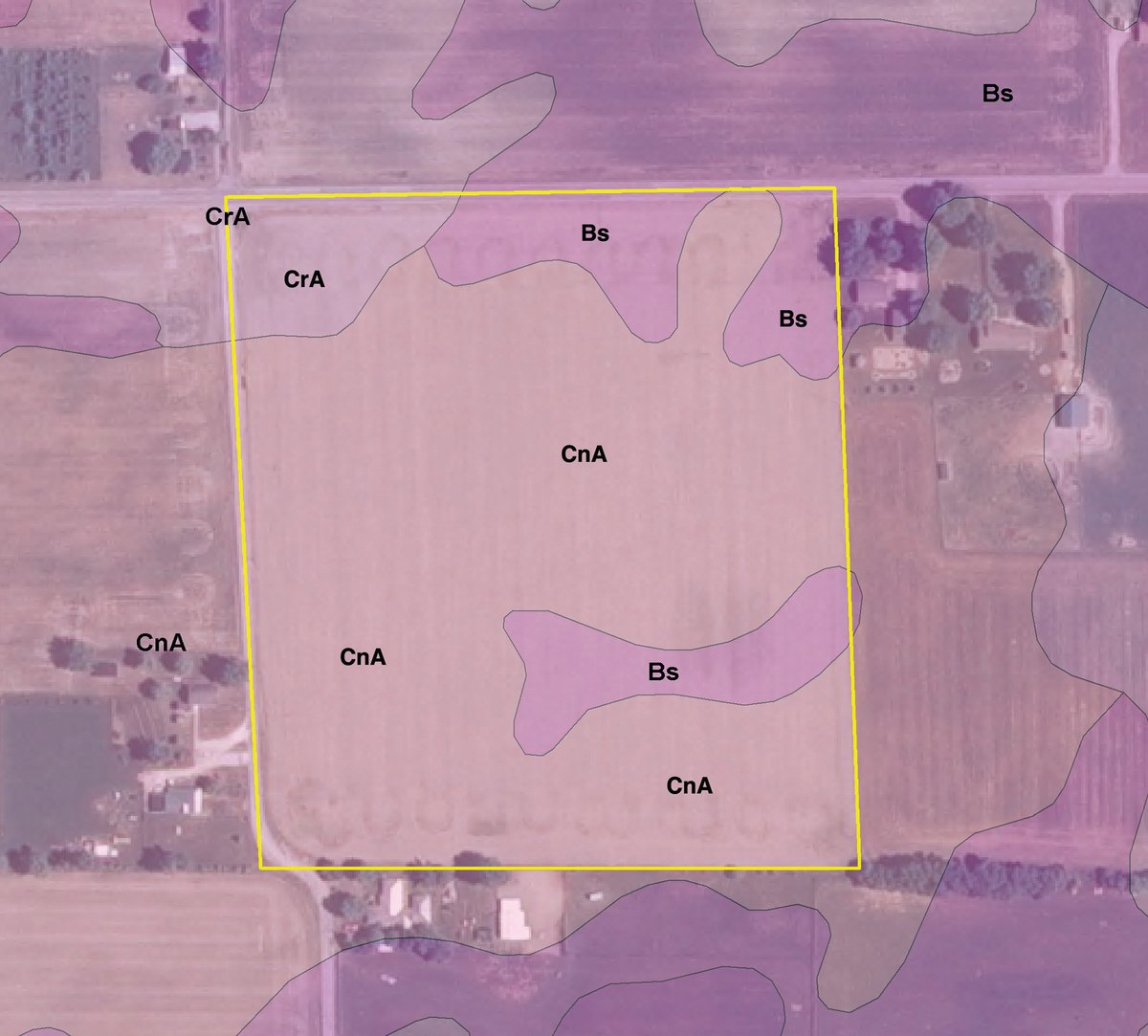
Tract 11
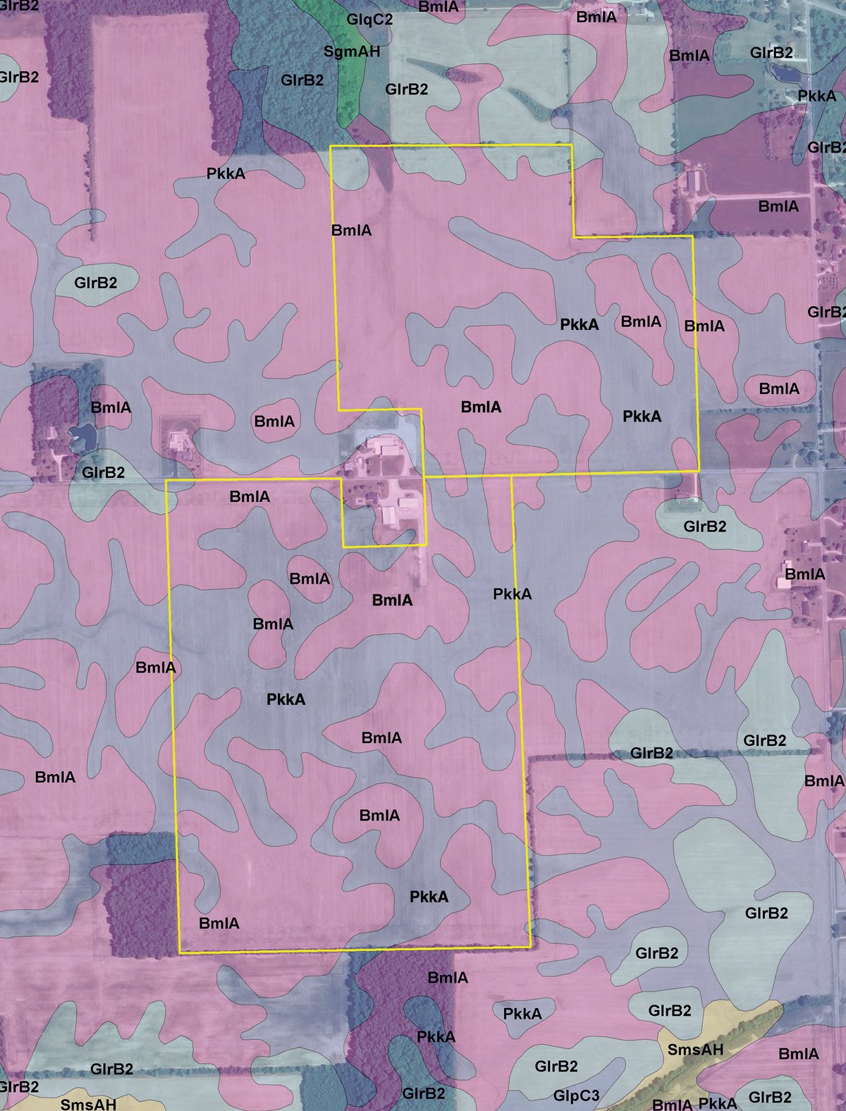
Tracts 12-13
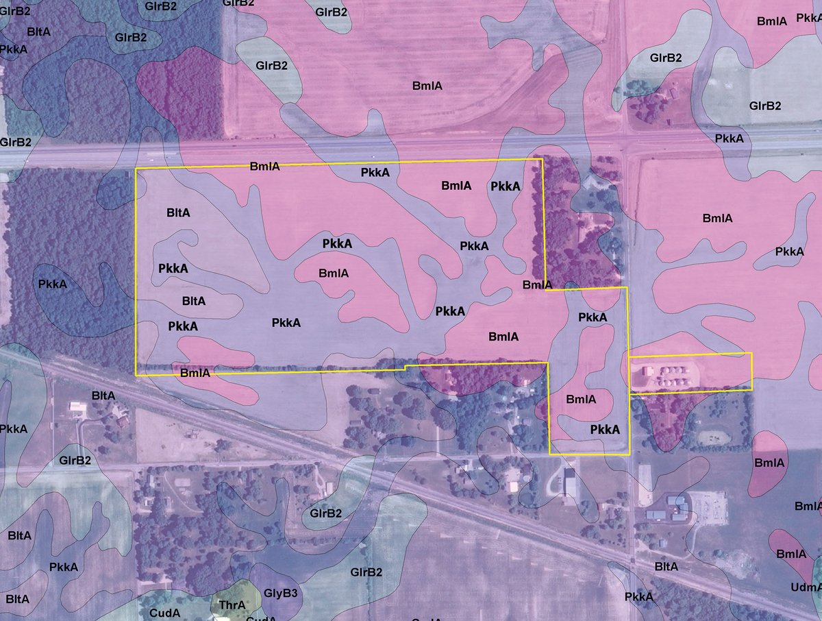
Tracts 14-15
AREA MAP(S)
PROCEDURE: The Properties will be offered in 15 individual tracts, any combination of tracts and as a total 833+/- acres, subject to swing tract limitations. There will be open bidding on all tracts and combinations during the auction as determined by the Auctioneer. Bids on tracts, tract combinations and the total property may compete.
DOWN PAYMENT: 10% down payment on the day of auction for individual tracts or combinations of tracts. The down payment may be made in the form of cashiers check, personal check, or corporate check. Immediate possession for agriculture purposes will be available for an additional 10% down payment. YOUR BIDDING IS NOT CONDITIONAL UPON FINANCING, so be sure you have arranged financing, if needed, and are capable of paying cash at closing.
ACCEPTANCE OF BID PRICES: All final bid prices are subject to the Sellers acceptance or rejection. All successful bidders will be required to sign Purchase Agreements at the auction site immediately following the close of the auction.
DEED: Seller shall provide a deed sufficient to convey insurance title to the real estate. Real estate is sold subject to all rights of way, legal highways, leases, easements of public record, and all other matters of public record.
EVIDENCE OF TITLE: Seller will provide a preliminary title insurance commitment to review prior to auction. Seller agrees to furnish Buyer(s) at Sellers expense an updated Owners Policy of Title Insurance prior to closing. CLOSING: The balance of the purchase price is due at closing, which will take place 30 days after the auction, or as soon thereafter as applicable closing documents are prepared by the Seller. Costs for an administered closing shall be shared 50:50 between Buyer(s) and Seller. All lender costs relative to the Buyer securing a mortgage shall be paid by the Buyer(s).
POSSESSION: Possession is at closing. Immediate possession is available, if Buyer so elects, for limited farming activities prior to closing, including spring planting. If Buyer elects to take possession prior to closing, Buyer will assume all responsibility and risks in connection with such activities. If Buyer elects to take possession prior to closing, Buyer must sign an addendum for pre-closing possession at the time of signing the purchase contract, which will require general liability insurance coverage in the amount of at least $1,000,000 combined single limit. Possession of the Grain Bins on Tract 15 will not be given until August 1, 2014.
REAL ESTATE TAXES: Buyer shall assume 2014 calendar year taxes due in 2015.
ACREAGE: All tract acreages, dimensions, and proposed boundaries are approximate and have been estimated based on current legal descriptions and/or aerial photos.
SURVEY: The Seller shall provide a new survey where there is no existing legal description or where new boundaries are created by the tract divisions in this auction or where Seller otherwise determines a survey is appropriate. Any need for a new survey shall be determined solely by the Seller. Seller and successful bidder shall each pay half (50:50) of the cost of the survey. Combination purchases will receive a perimeter survey only. Final sales price shall be adjusted to reflect any difference between advertised and surveyed acres.
PROPERTY INSPECTION: Each potential Bidder is responsible for conducting, at their own risk, their own independent inspections, investigations, inquiries and due diligence concerning the property. Inspection dates have been scheduled and will be staffed with auction personnel. Further, Seller disclaims any and all responsibility for Bidders safety during any physical inspection of the property. No party shall be deemed an invitee of the property by virtue of the offering of the property for sale.
EASEMENTS: Subject to any and all existing easements.
AGENCY: Schrader Real Estate & Auction Company, Inc. and its representatives are exclusive agents of the Seller.
STOCK PHOTOGRAPHY: Some crop photos are for illustrative purposes only and were not taken on the property.
DISCLAIMER AND ABSENCE OF WARRANTIES: All information contained in this brochure and all related materials are subject to the terms and conditions outlined in the Purchase Agreement. The property is being sold on an AS IS, WHERE IS basis, and no warranty or representation, either expressed or implied, concerning the property is made by the Seller or the Auction Company. All sketches and dimensions in the brochure are approximate. Each potential bidder is responsible for conducting his or her own independent inspections, investigations, inquiries, and due diligence concerning the property. The information contained in this brochure is subject to verification by all parties relying on it. No liability for its accuracy, errors, or omissions is assumed by the Seller or the Auction Company. Conduct of the auction and increments of bidding are at the direction and discretion of the Auctioneer. The Seller and Selling Agents reserve the right to preclude any person from bidding if there is any question as to the persons credentials, fitness, etc. All decisions of the Auctioneer are final. ANY ANNOUNCEMENTS MADE THE DAY OF THE SALE TAKE PRECEDENCE OVER PRINTED MATERIAL OR ANY OTHER ORAL STATEMENTS MADE.

Click to access


