


• 440+/- Acres offered in 17 Tracts • From 3+/- to 102+/- Acres • Surrounding Cross Timbers Marina & Adjacent to Tall Chief Cove Recreation Area • Elevated Lake Views • Mature Hardwoods • Open Meadows • Ponds & Creeks • Development, Home-Site & Recreational Potential

LAND AUCTION - 440+/- ACRES OFFERED IN 17 TRACTS IN OSAGE CO., OKLAHOMA
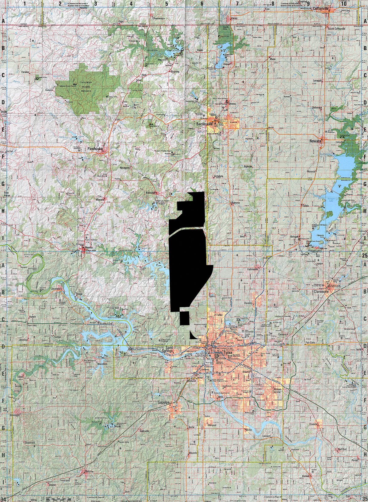
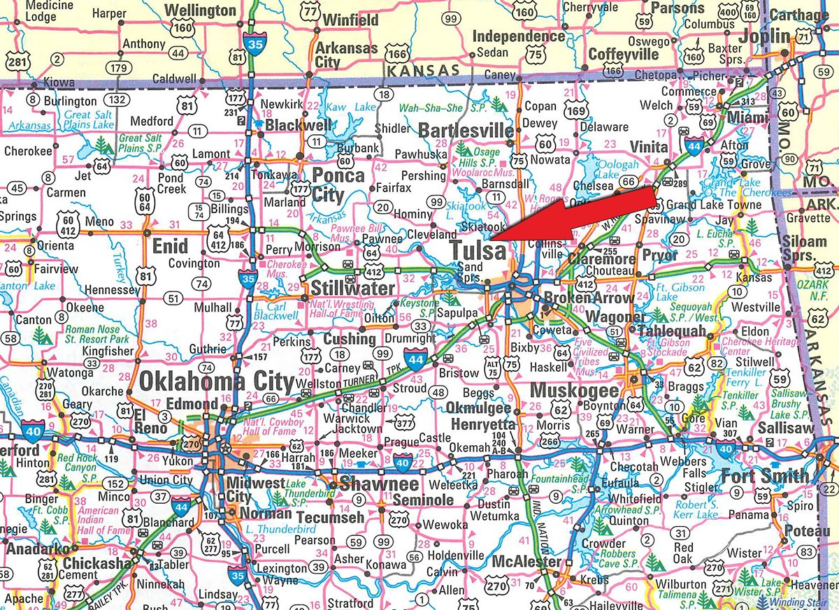
Osage County, Oklahoma
Owner: Drummond Skiatook Ranch Tue, Sep 27, 2016 EASTERNAUCTION IS OVER
TOTAL SOLD: $2,903,940
| Tract(s): 1-3 | @ $515,100 | ($7,688/acre) |
| Tract(s): 4 | @ $142,800 | ($12,982/acre) |
| Tract(s): 5 | @ $153,000 | ($12,750/acre) |
| Tract(s): 6+7 | @ $321,300 | ($13,970/acre) |
| Tract(s): 8 | @ $107,100 | ($6,300/acre) |
| Tract(s): 9 | @ $98,940 | ($6,596/acre) |
| Tract(s): 10 | @ $86,700 | ($5,780/acre) |
| Tract(s): 11-17 | @ $1,479,000 | ($5,100/acre) |
OPEN HOUSE/INSPECTION DATES
Wednesday, August 31st, 9-11 AM
Tuesday, September 20th, 9-11 AM
Monday, September 26th, 4-6PM
Meet a Schrader representative at The Springs Event Venue parking lot
PROPERTY LOCATION
From downtown Tulsa take a LL Tisdale Parkway north and exit on Apache Street, turn left and travel for approximately 9.5 miles as the street becomes N 52nd W Ave. At the intersection of W 103rd Street North, turn left and follow for 1.5 miles and property will begin on your left.
AUCTION LOCATION
The Springs Event Venue, 10367 Tallchief Village Circle, Sperry, OK 74073
Directions: Auction site sits adjacent to Tract 7, within the Tall Chief Cove Recreation Area.
PROPERTY DESCRIPTION
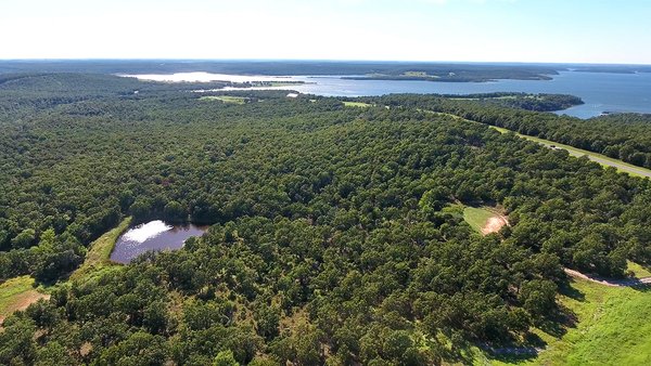
440 +/- acres offered in 17 tracts from 3+/- to 102+/- acres overlooking Skiatook Lake in Osage County, Oklahoma. This ranch is a unique opportunity to acquire an attractive combination of land with development, home-site and recreational potential near Cross Timbers Marina and adjacent to Tall Chief Cove Recreation Area on Skiatook Lake. Featuring a blend of elevated lake view ridges, with elevations to 950 feet, mature hardwoods, open meadows, ponds and creeks this property has a diversity of terrain attractive to many different Buyers. We have parceled the property in a manner that allows Buyers to pursue individual parcels or a combination of tracts that best fit their needs!
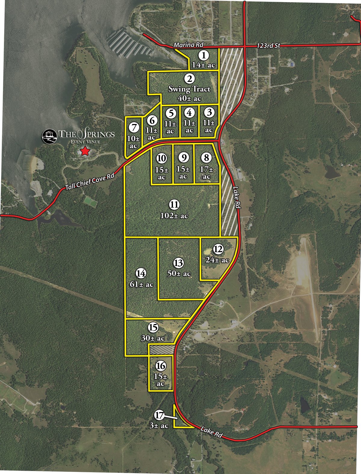
TRACT DESCRIPTIONS
Tract 1:
14± ac
with approximately 1,200 feet of frontage along Marina Drive. This tract is adjacent to Cross Timbers Marina and has potential for development or an individual home-site.
Tract 2:
40± ac
SWING TRACT with approximately 1,700 feet of frontage along Corps of Engineers/US Government land, which fronts Skiatook Lake. Tract Two has an elevated ridgeline which traverses diagonally through the tract and offers outstanding topography for future development or a private estate.
Tract 3:
11± ac
on the corner of Lake Rd and Tall Chief Cover Rd, heavily wooded with great elevation.
Tract 4:
11± ac
with approximately 500 feet of frontage along Tall Chief Cove Rd, this parcel is heavily wooded and easily has navigable topography.
Tract 5:
11± ac
with approximately 500 feet of frontage along Tall Chief Cove Rd, this parcel consists of a nice ridgeline and wet weather creek running along the north side.
Tract 6:
11± ac
with over 500 feet of frontage along Tall Chief Cove Rd with a nice level topography along the road.
Tract 7:
10± ac
with Tall Chief Cove Rd frontage on two sides, this parcel is heavily woods and easily accessible from different locations.
Tract 8:
17± ac
on the corner of Lake Rd and Tall Chief Cove Rd. This parcel is heavily wood, has great topography changes and features a clear, deep pond on the southern on of the tract.
Tract 9:
15± ac
with over 500 feet of frontage along Tall Chief Cove Rd. This tract is level along the roadside of tapers toward the south into a deep creek bottom on the adjacent tract.
Tract 10:
15± ac
with over 500 feet of frontage along Tall Chief Cove Rd. This parcel is very level on the northeastern corner and tapers to the south overlook a beautiful creek bottom.
Tract 11:
102± ac
with over 1,900 feet of contiguous fence line with the Tall Chief Cover Recreation Area. This parcel offers an outstanding opportunity for a unique recreational tract and has many suitable home-sites.
Tract 12:
24± ac
with over 1,000 feet of frontage along Lake Rd. This parcel features a combination of open meadow, a nice pond, mature hardwoods and level topography.
Tract 13:
50± ac
with frontage along Lake Road and over 1,300 feet of the highest ridgeline on the entire ranch, reaching 950 feet. Terrific vistas of the lake, mature hardwoods, a small pond and some open pasture create an attractive combination of features on this parcel.
Tract 14:
61± ac
with frontage along Lake Road and over 2,000 feet of the highest ridgeline on the entire ranch, reaching 950 feet. This parcel has some wonderful vistas of the surrounding landscape, including the lake of meadows to the south. These views combined with open pastureland and mature hardwoods make an exceptional recreational, home-site or development tract.
Tract 15:
30± ac
with approximately 800 feet of frontage along Lake Road. This parcel has a combination of open pasture, mature hardwoods and a great ridge line running along the western side.
Tract 16:
15± ac
with approximately 900 feet of frontage along Lake Road. This parcel is a combination open meadows, a small wet weather creek and mature hardwoods.
Tract 17:
3± ac
rectangular parcel with approximately 700 feet of frontage along Lake Road and is mostly mature hardwood timber.
TRACT MAP(S)
AREA MAP(S)
PROCEDURE: Tracts 1 through 17 will be offered in individual tracts, in any combination of these tracts, or as a total unit per auction date and time. There will be open bidding on all tracts and combinations during the auctions as determined by the Auctioneer. Bids on tracts, tract combinations and the total property may compete. The property will be sold in the manner resulting in the highest total sale price.
BUYERS PREMIUM: The contract purchase price will include a Buyers Premium equal to 2% of the bid amount.
DOWN PAYMENT: 10% of the total contract purchase price will be due as a down payment on the day of auction, with the balance due in cash at closing. The down payment may be made in the form of cashiers check, personal check, or corporate check. YOUR BIDDING IS NOT CONDITIONAL UPON FINANCING, SO BE SURE YOU HAVE ARRANGED FINANCING, IF NEEDED, AND ARE CAPABLE OF PAYING CASH AT CLOSING.
APPROVAL OF BID PRICES: All successful bidders will be required to enter into purchase agreements at the auction site immediately following the close of the auction. The auction bids are subject to the acceptance or rejection by the Seller.
DEED: Seller shall be obligated only to convey a merchantable title by Warranty Deed.
EVIDENCE OF TITLE: Seller agrees to make available to bidder a preliminary title insurance commitment to review prior to auction. The cost of title insurance, if the buyer(s) elects to purchase the title insurance policy, will be the responsibility of the buyer(s). Seller agrees to provide merchantable title to the property subject to matters of record, general conditions of title, and similar related matters. All tracts sold AS-IS.
CLOSING: The closing shall take place 45 days after the auction or as soon thereafter as applicable closing documents are completed by Seller.
POSSESSION: Possession of the land shall be at closing or as soon thereafter as any applicable lease agreements expire.
REAL ESTATE TAXES: Real Estate taxes shall be prorated to the date of closing.
MINERALS: Property is located with Osage County, all minerals are owned by the Osage Tribal Nation.
SURVEY: The Seller shall provide a new survey where there is no existing legal description or where new boundaries are created by the tract divisions in this auction. Any need for a new survey shall be determined solely by the Seller. Seller and successful bidder shall each pay half (50:50) of the cost of the survey. The type of survey performed shall be at the Sellers option and sufficient for providing title insurance. Closing prices shall be adjusted to reflect any difference between advertised and surveyed acres, if a new survey is determined to be necessary by the Seller.
ACREAGE AND TRACTS: All acreages are approximate and have been estimated based on current legal descriptions and/or aerial photos. Any corrections, additions, or deletions will be made known prior to the auction.
AGENCY: Schrader Real Estate and Auction Company, Inc. and their representatives are exclusive agents of the Seller.
DISCLAIMER AND ABSENCE OF WARRANTIES: All information contained in this brochure and all related materials are subject to the terms and conditions outlined in the Purchase Agreement. The property is being sold on an AS IS, WHERE IS basis, and no warranty or representation, either expressed or implied, concerning the property is made by the Seller or the Auction Company. All sketches and dimensions in the brochure are approximate. Each potential bidder is responsible for conducting his or her own independent inspections, investigations, inquiries, and due diligence concerning the property. The information contained in this brochure is subject to verification by all parties relying on it. No liability for its accuracy, errors, or omissions is assumed by the Seller or the Auction Company. Conduct of the auction and increments of bidding are at the direction and discretion of the Auctioneer. The Seller and Selling Agents reserve the right to preclude any person from bidding if there is any question as to the persons credentials, fitness, etc. All decisions of the Auctioneer are final. ANY ANNOUNCEMENTS MADE THE DAY OF THE SALE TAKE PRECEDENCE OVER PRINTED MATERIAL OR ANY OTHER ORAL STATEMENTS MADE.
NEW DATE, CORRECTIONS AND CHANGES: Please arrive prior to scheduled auction time to inspect any changes or additions to the property information.


