


• Productive Farmland • Immediate Possession • 2011 Crop Rights • Great Location - Convenient to New Castle & Muncie - Within 3 Miles of Summit Lake State Park
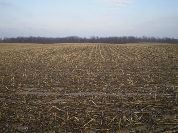
71 Acres Offered in 2 Tracts
Henry County - Prairie Twp.
Owner: Eddie & Jenee King Tue, Apr 5, 2011 EASTERNAUCTION IS OVER
OPEN HOUSE/INSPECTION DATES
Saturday, March 19 from 9-11 AM
PROPERTY LOCATION
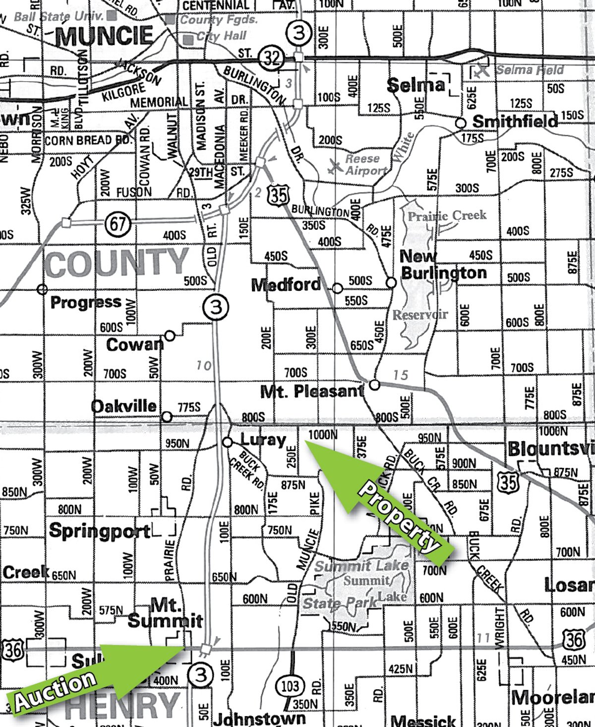
From New Castle: Travel north on SR 3 approximately 9.5 miles to County Road 950N (Luray Rd.); turn right (east) and travel approximately 1/4 mile to CR 100E; turn left (north) and travel ½ mile to CR 800S (also County Line Road); turn right (east) for 1.5 miles to the property at intersection of CR 800S & CR 250E. From Muncie: From the intersection of SR 3 and the Muncie Bypass on the south side of Muncie travel south on SR 3 approximately 4 miles to CR 700S, turn left (east) for 1 mile to CR 200E, then turn right (south) for 1 mile to CR 800S (also County Line Road), then turn left (east) for 1/2 mile to the property at the intersection of CR 800S & CR 250E.
AUCTION LOCATION
Prairie Township Community Building 104 W. Main St., Mt. Summit, IN Mt. Summit is approximately 1/4 mile west of the SR 3/US 36 interchange.
TRACT DESCRIPTIONS
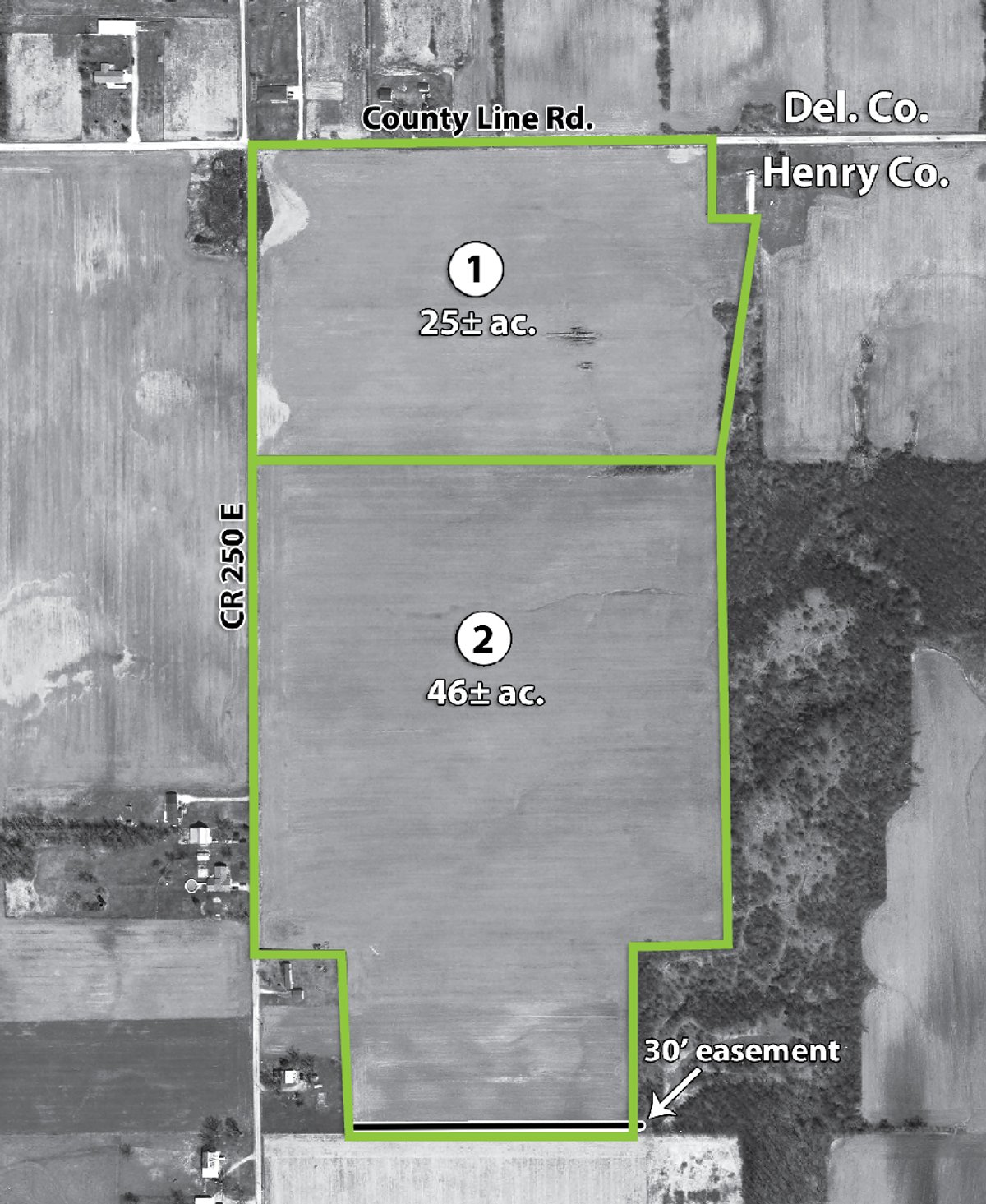
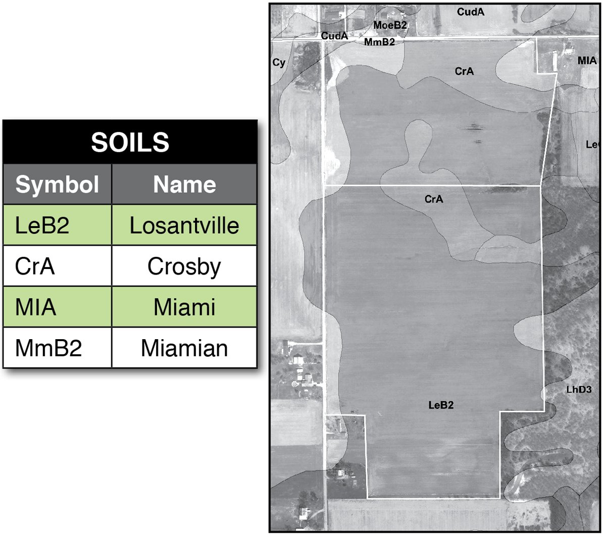
Tract 1: 25± ac All tillable with Crosby, Miami and Losantville soils. Perfect to combine with Tract 2. Frontage on County Line Rd. and CR 250E.
Tract 2: 46± ac Nearly all tillable. A great place for your mini-farm or to combine with Tract 1. Crosby, Miami and Losantville soils. Frontage on CR 250E. Ingress/Egress easement in place on south end.
AREA MAP
TRACT MAP(S)
SOIL INFORMATION
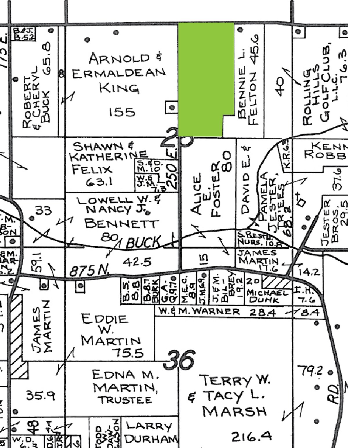
PLAT MAP(S)
AREA MAP(S)
PROCEDURE: The property will be offered in 2 individual tracts and as a total 71 acre unit. There will be open bidding on all tracts and combinations during the auction as determined by the Auctioneer. Bids on tracts, tract combinations and the total property may compete.
DOWN PAYMENT: 10% down payment on the day of auction for individual tracts or combinations of tracts. The down payment may be made in the form of cash, cashier’s check, personal check, or corporate check. YOUR BIDDING IS NOT CONDITIONAL UPON FINANCING, so be sure you have arranged financing, if needed, and are capable of paying cash at closing.
ACCEPTANCE OF BID PRICES: All successful bidders will be required to enter into Purchase Agreements at the auction site immediately following the close of the auction. All final bid prices are subject to the Sellers’ acceptance or rejection.
EVIDENCE OF TITLE: Seller shall provide an owner’s title insurance policy in the amount of the purchase price.
DEED: Warranty Deed.
CLOSING: The balance of the purchase price is due at closing, which will occur within 15 days of marketable title. Costs for an insured closing shall be shared 50:50 between Buyer(s) and Seller.
POSSESSION: Possession is at closing. Possession with 2011 Farm Rights with 20% down payment.
FSA INFORMATION: Farm #7672. Soybean Base: 53.1 with Direct Yield of 34.
REAL ESTATE TAXES: Buyer(s) will assume all taxes due May 2012 and thereafter. 2009/2010 Taxes were approximately $482.
ACREAGE: All tract acreages, dimensions, and proposed boundaries are approximate and have been estimated based on current legal descriptions and/or aerial photos.
SURVEY: The Seller shall provide a new survey where there is no existing legal description or where new boundaries are created by the tract divisions in this auction. Any need for a new survey shall be determined solely by the Seller. Seller and successful bidder shall each pay half (50:50) of the cost of the survey. The type of survey performed shall be at the Seller’s option and sufficient for providing title insurance. Combination purchases will receive a perimeter survey only.
AGENCY: Schrader Real Estate & Auction Company, Inc. and its representatives are exclusive agents of the Seller.
DISCLAIMER AND ABSENCE OF WARRANTIES: All information contained in this brochure and all related materials are subject to the terms and conditions outlined in the Purchase Agreement. The property is being sold on an â€
None at this time


