

QUALITY LAND AUCTION - 249.5+/-ACRES OFFERED IN 9 TRACTS IN MARSHALL COUNTY, INDIANA
16th Rd, Argos, IN 46501 - Marshall County, Indiana · Owner: TBC Properties LLC
- Auction dateThu, Nov 19, 6:00 PM ET
- Acres249.5±
- Tracts9
- Auction held atMarshall County Fairgrounds (Gallery on West)
202 West St, Argos, Indiana 46501
Exit US-31 and proceed east on SR 10 towards Argos. Turn south onto West St.
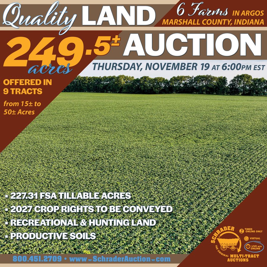
- 227.31 FSA TILLABLE ACRES
- 2027 CROP RIGHTS TO BE CONVEYED
- RECREATIONAL & HUNTING LAND
- PRODUCTIVE SOILS
Open house / inspection dates
Saturday October 17, 2026 from 10am-12pm
Thursday November 12, 2026 from 4-6pm
Meet at Tract 1.
Property location
16th Rd, Argos, IN 46501
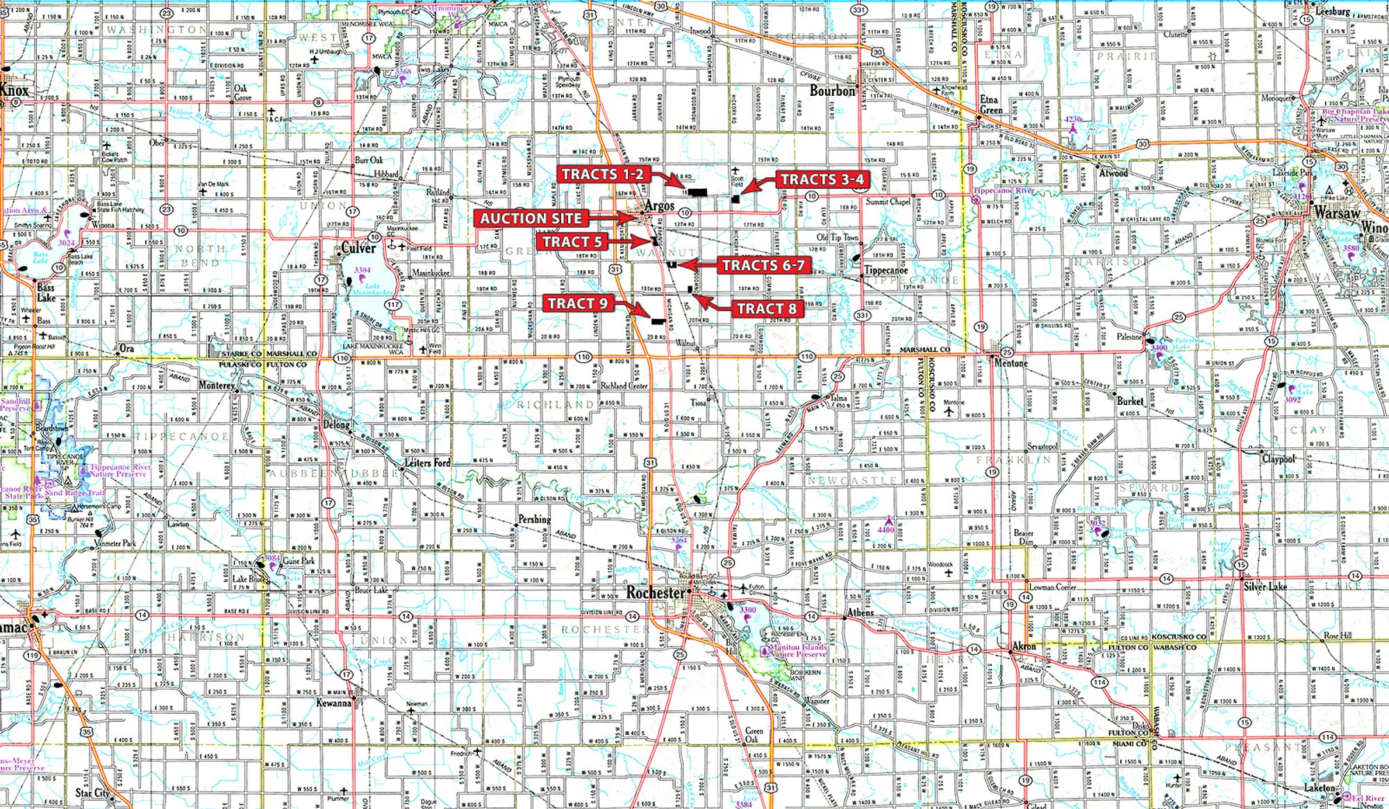
TRACTS 1, 2, 3 & 4: From the intersection of US-31 & SR 10, head east on SR 10 for 1.6 miles. Then turn north onto Juniper Rd. Continue on Juniper Rd for a 1/2 mile, then turn onto 16th Rd. In 0.8 miles, Tracts 1 & 2 will be on your left. Continue on 16th Rd until the T-intersection with Hickory Rd. Then turn south; Tracts 3 & 4 will be on your left.
TRACTS 5, 6 & 7: Take Michigan Rd/Old US 31 south out of Argos. Cross the railroad tracks south of town and continue for approximately a 1/2 mile. Tract 5 will be on your left. Continue South on Michigan Rd/Old US 31 for 0.7 miles. Turn left on 18th Rd. Continue on 18th Rd for 0.4 miles. Tracts 6 and 7 will be on your right.
TRACT 8: Start on Michigan Rd/Old US 31 South out of Argos to 19th Rd. Turn left onto 19th Rd. Tract 8 will be 0.8 miles on the left side of the road.
TRACT 9: From the intersection of US 31 & SR 110, head east on SR 110 for 1/2 mile until the 4-way stop at SR 110 and Michigan Rd/Old US 31. Then head north for 1.2 miles. Tract 9 will be on your left.
Auction location
Marshall County Fairgrounds (Gallery on West)
202 West St, Argos, Indiana 46501
Exit US-31 and proceed east on SR 10 towards Argos. Turn south onto West St.
Property description
Don't miss your chance at this outstanding 249.5+/- acre offering in Marshall County, IN - nine tracts packed with opportunity for the farmer, hunter, and investor alike! The majority of this ground is prime, tillable farmland ready for row-crop production, with easy access. Mixed throughout are pockets of woods and native grassland that create outstanding wildlife habitat, giving buyers the rare chance to farm it, hunt it, or do both. Whether you're looking to add acreage to an existing operation, grow your investment portfolio, or land a private slice of recreational ground - this property delivers size, shape, access, and versatility all in one offering. Soil productivity information available upon request. Sold in tracts, combinations, or as a whole - this is one you don't want to pass up!
Tract descriptions
| Tract | Acres | Description |
|---|---|---|
| 1 | 50± | comprised with a 148 WAPI index. Primary soils are Riddles-Oshtemo fine sandy loam and Brookston loam. Excellent road frontage. |
| 2 | 40± | of tillable and native grassland. Potential to lease out farmable land and hunt the property yourself. |
| 3 | 23.1± | comprised with a 128 WAPI index. Primary soils are Brems-Morocco loamy sand and Maumee mucky loamy fine sand. Property is mostly tillable land with approximately 1.5+/- acres of woods |
| 4 | 15± | comprised with a 150 WAPI index. Primary soils are Rensselaer loam and Maumee mucky loamy fine sand. Nearly 100% tillable farmland. |
| 5 | 26± | comprised with a 146 WAPI index. Primary soils are Rensselaer loam and Riddles- Oshtemo fine sandy loam. Property is easily accessible and contains approximately 1.4+/- acres of woods. |
| 6 | 15.3± | comprised with a 131 WAPI index. Primary soils are Riddles-Oshtemo fine sandy loam and Brookston loam. Excellent road frontage. |
| 7 | 17± | comprised with a 137 WAPI index. Primary soils are Riddles-Oshtemo fine sandy loam and Rensselaer loam. Great rectangular piece to add to your farming operation or portfolio. |
| 8 | 18.7± | comprised with a 150 WAPI index. Primary soils are Crosier loam and Riddles-Oshtemo fine sandy loam. Excellent road frontage and a great shape to the property. |
| 9 | 44.3± | comprised with a 146 WAPI index. Primary soils are Houghton muck and Riddles-Metea complex. Exceptional road frontage on Michigan Rd/Old US 31. This property is a mix of tillable and wooded land. The wooded land makes up nearly 7.6+/- acres. |
Interactive map
Tract map
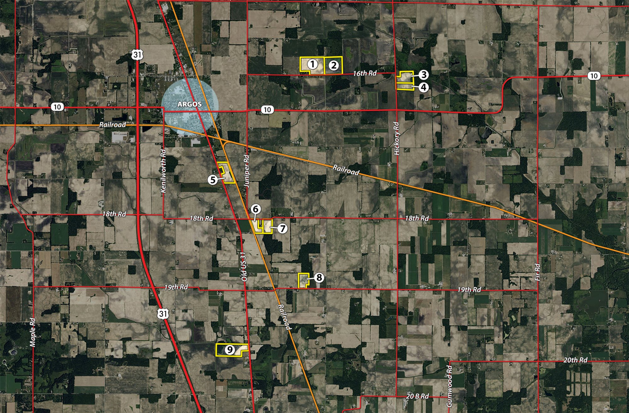
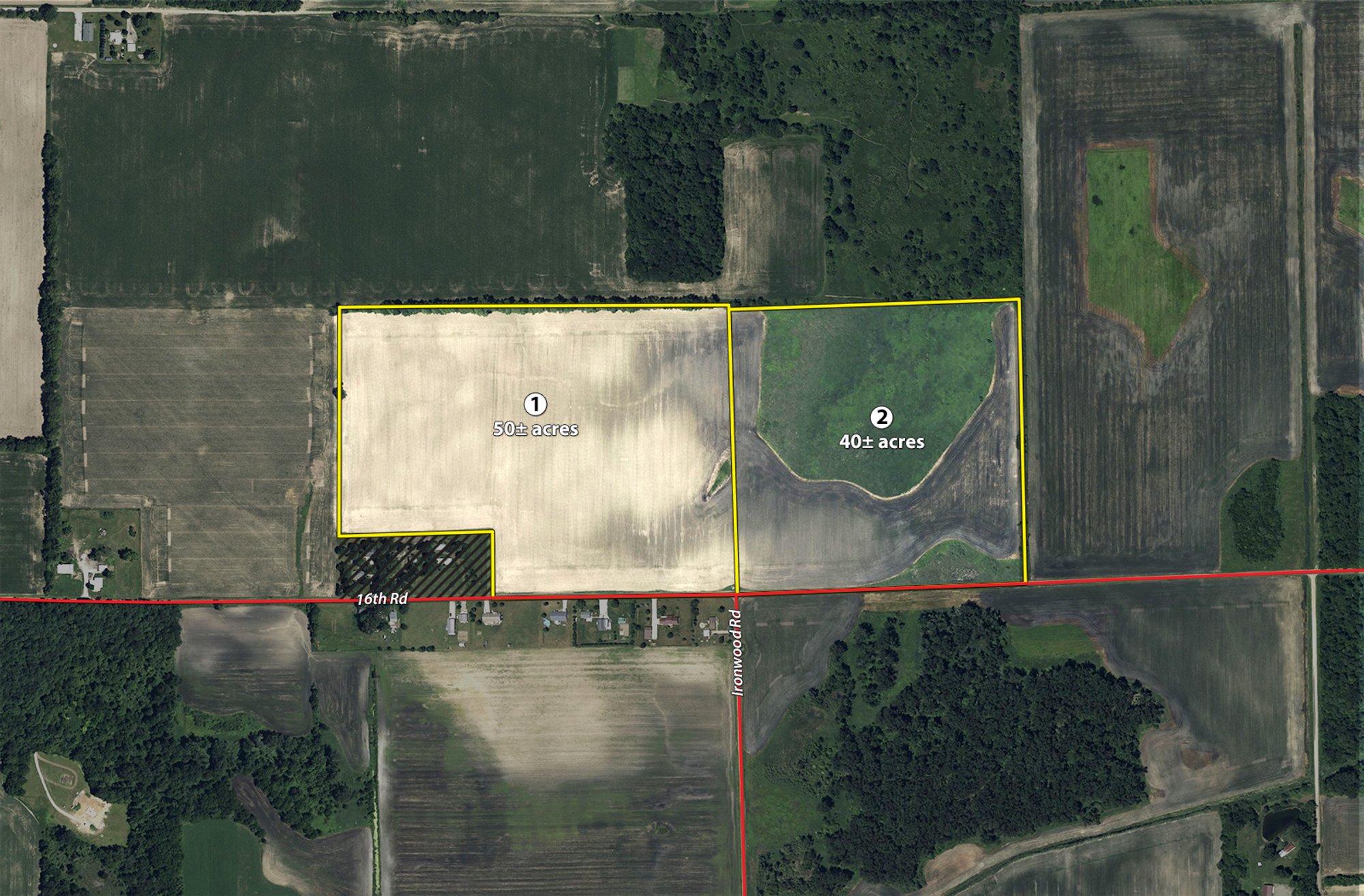
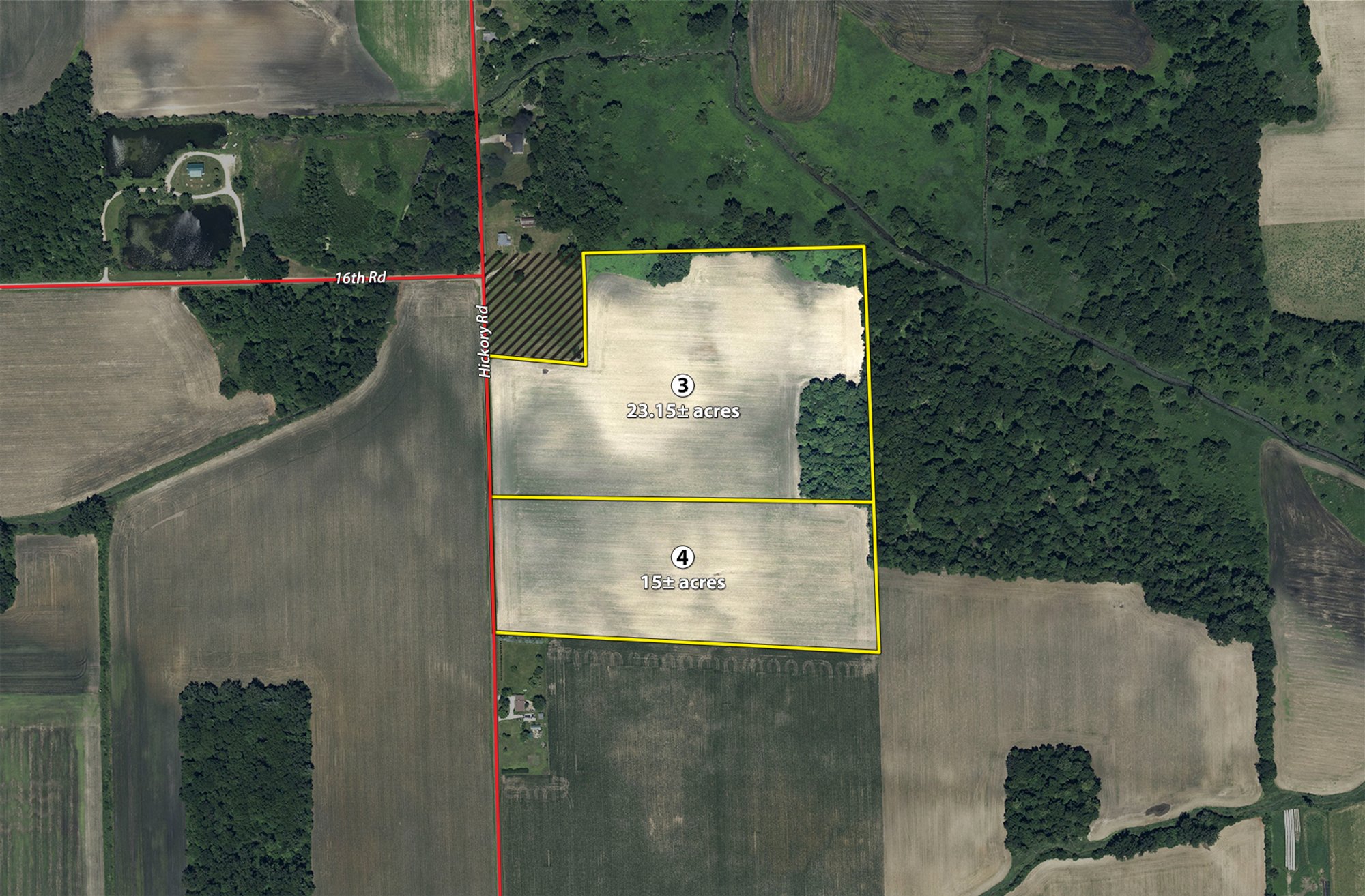
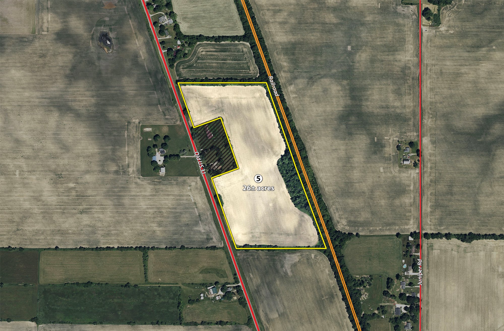
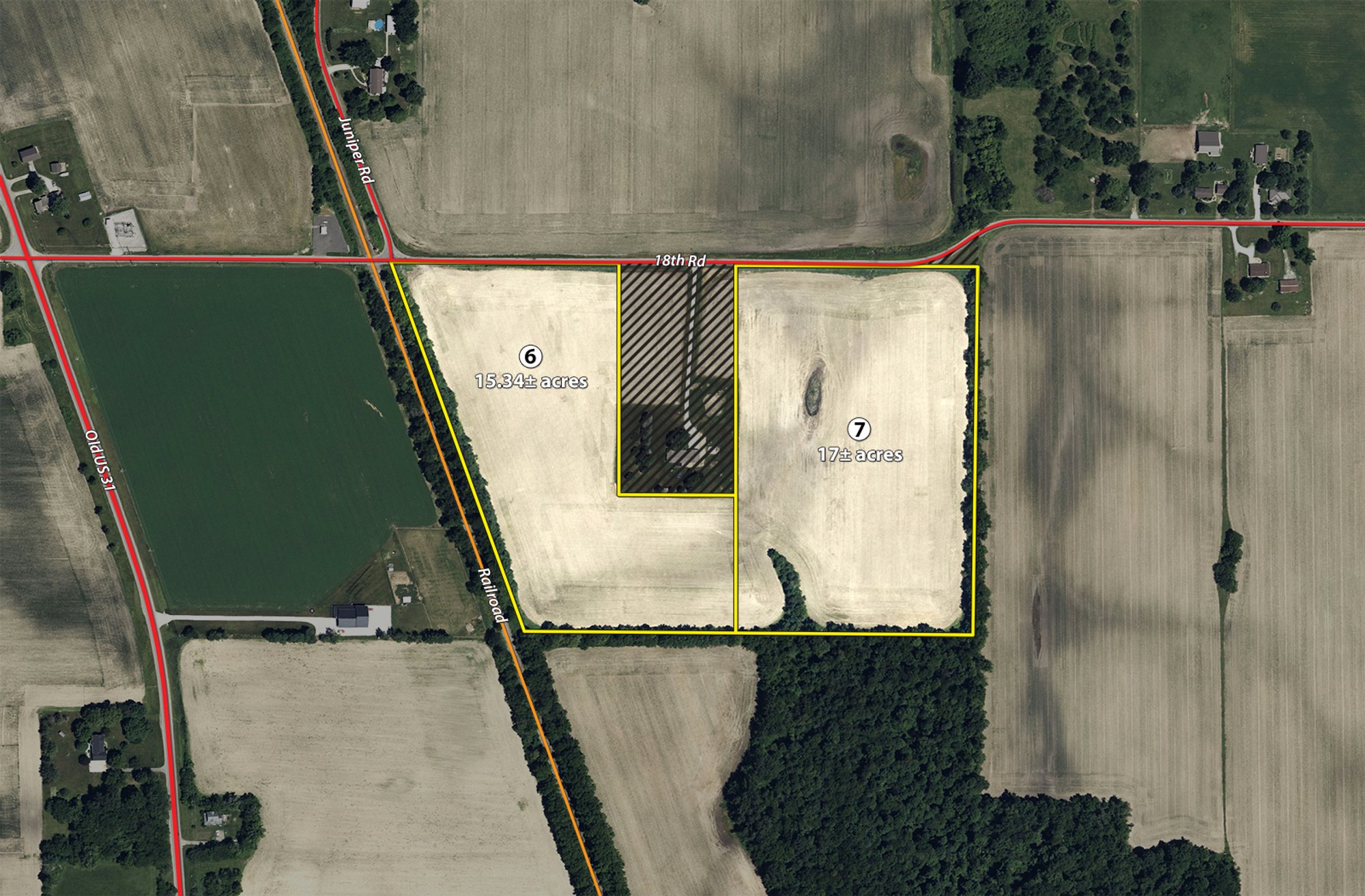
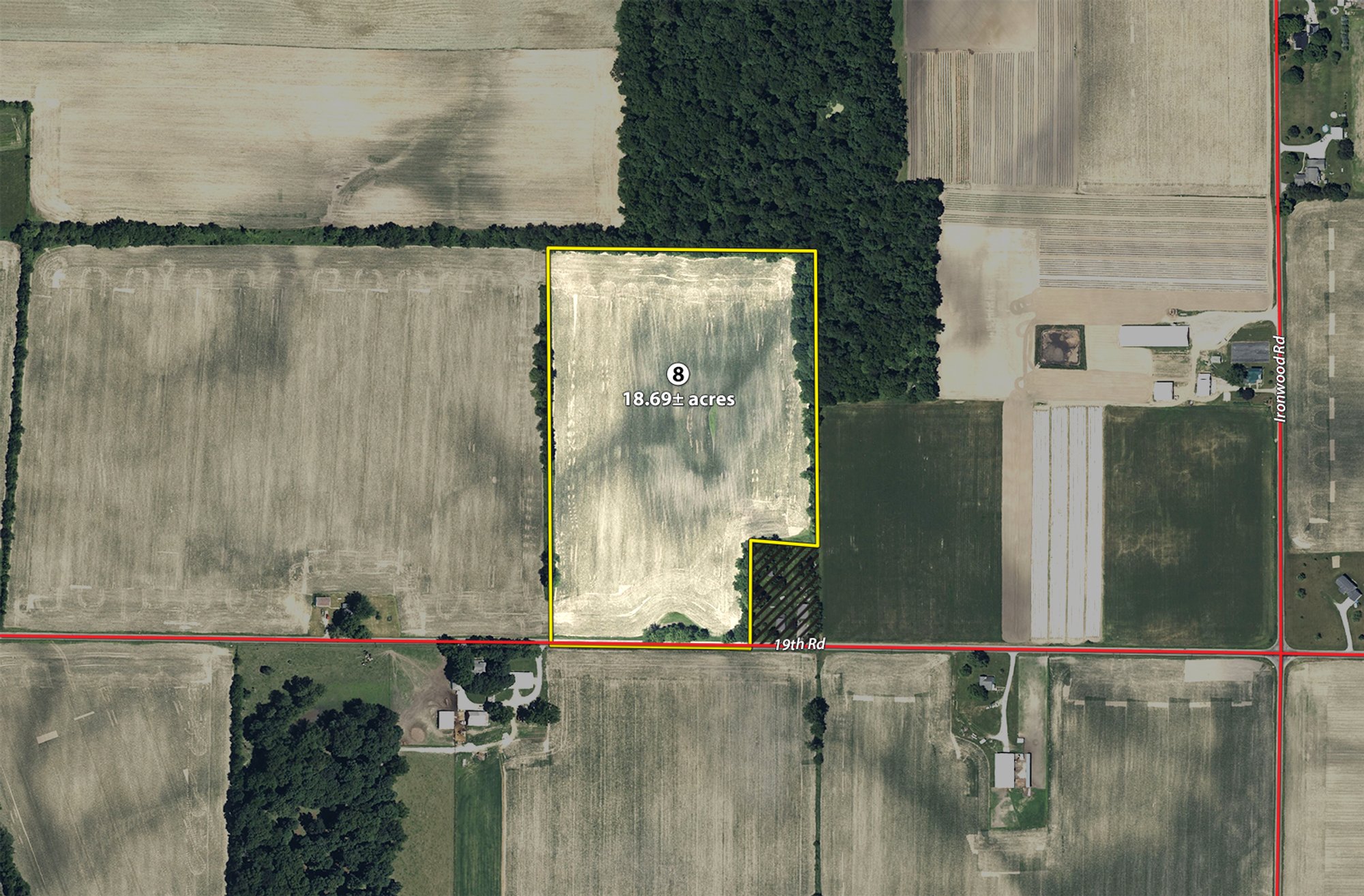
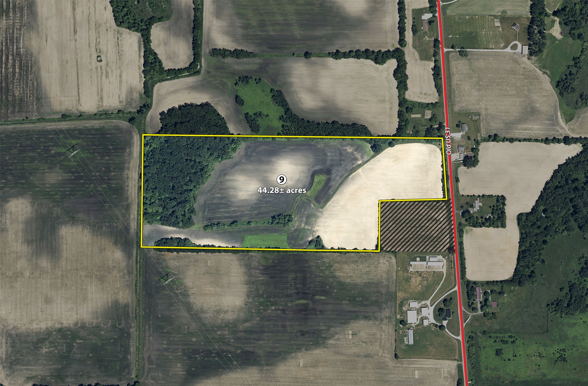
Area map
Terms
PROCEDURE: The property will be offered in 9 individual tracts, any combination of tracts, and as a total 249.5+/- acre unit. There will be open bidding on all tracts and combinations during the auction as determined by the Auctioneer.
DOWN PAYMENT: 10% down payment on the day of auction for individual tracts or combinations of tracts. The down payment may be made in the form of cashier's check, personal check, or corporate check. YOUR BIDDING IS NOT CONDITIONAL UPON FINANCING, so be sure you have arranged financing, if needed, and are capable of paying cash at closing.
ACCEPTANCE OF BID PRICES: All successful bidders will be required to enter into Purchase Agreements at the auction site immediately following the close of the auction. All final bid prices are subject to the Sellers' acceptance or rejection.
EVIDENCE OF TITLE: Seller shall provide an owner's title insurance policy in the amount of the purchase price.
DEED: Seller shall provide Warranty Deed(s).
CLOSING: The targeted closing date will be approximately 45 days after the auction.
POSSESSION: Possession is at closing, subject to harvest of 2026 crop.
REAL ESTATE TAXES: Seller to pay all 2026 real estate taxes due & payable in 2027. Buyer(s) will be responsible for all taxes due thereafter.
PROPERTY INSPECTION: Each potential Bidder is responsible for conducting, at their own risk, their own independent inspections, investigations, inquiries and due diligence concerning the property. Inspection dates have been scheduled and will be staffed with auction personnel. Further, Seller disclaims any and all responsibility for Bidder's safety during any physical inspection of the property. No party shall be deemed an invitee of the property by virtue of the offering of the property for sale.
ACREAGE: All tract acreages, dimensions and proposed boundaries are approximate and have been estimated based on current legal descriptions and/or aerial photos.
SURVEY: The Seller shall provide a new survey where there is no existing legal description or where new boundaries are created by the tract divisions in this auction. Any need for a new survey shall be determined solely by the Seller. Seller and successful bidder shall each pay half (50:50) of the cost of the survey. The type of survey performed shall be at the Seller's option and sufficient for providing title insurance. Combination purchases will receive a perimeter survey only.
AGENCY: Schrader Real Estate & Auction Company, Inc. and its representatives are exclusive agents of the Seller.
DISCLAIMER AND ABSENCE OF WARRANTIES: All information contained in this brochure and all related materials are subject to the terms and conditions outlined in the Purchase Agreement. The property is being sold on an "AS IS, WHERE IS" basis, and no warranty or representation, either expressed or implied, concerning the property is made by the Seller or the Auction Company. All sketches and dimensions in the brochure are approximate. Each potential bidder is responsible for conducting his or her own independent inspections, investigations, inquiries and due diligence concerning the property. The information contained in this brochure is subject to verification by all parties relying on it. No liability for its accuracy, errors or omissions is assumed by the Seller or the Auction Company. Conduct of the auction and increments of bidding are at the direction and discretion of the Auctioneer. The Seller and Selling Agents reserve the right to preclude any person from bidding if there is any question as to the person's credentials, fitness, etc. All decisions of the Auctioneer are final.
ANY ANNOUNCEMENTS MADE THE DAY OF THE SALE TAKE PRECEDENCE OVER PRINTED MATERIAL OR ANY OTHER ORAL STATEMENTS MADE.
Documents & downloads
Photos


